

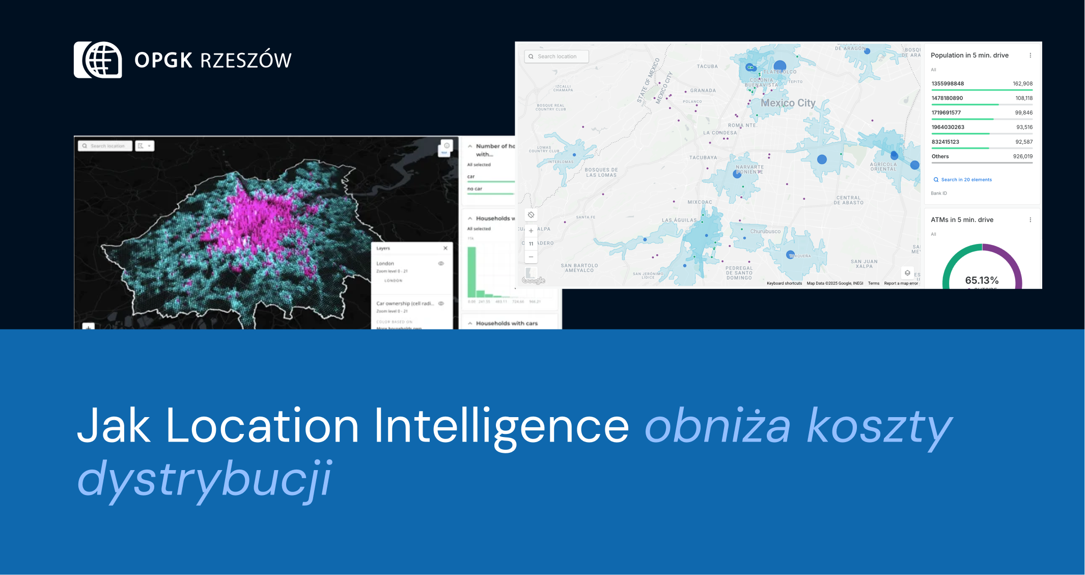
Entering the Era of Location: The Role of Location Intelligence in Business
Opublikowano:
2022-09-30 14:12
In today's global business environment, data plays an incredibly important role in making key decisions. However, not all data is equal, and one of the key differentiating factors is location. Therefore, the concept of "Location Intelligence" is becoming increasingly prevalent in business circles. But is it just a trend, or does it truly matter? In this article, we'll take a closer look at this issue and expand on why Location Intelligence is much more than just a buzzword.


.png)
.png)
.png)


.png)
.png)
.png)


.png)
.png)
.png)

.png)
.png)
.png)
.png)
.png)
.png)
.png)
.png)
.png)


.png)
.png)
.png)
.png)
.png)
.png)
.png)
.png)

.png)
.png)

.png)
.png)
.png)